
At a glance
- Duration: 14 days
- Maximum altitude: 5,364 m (Base Camp)
- Difficulty: demanding because of the altitude, no technical sections
- Accommodation: mountain lodges (teahouses)
- Best time: spring (March to May), autumn (October and November) and the first half of December
- Starting point: Kathmandu
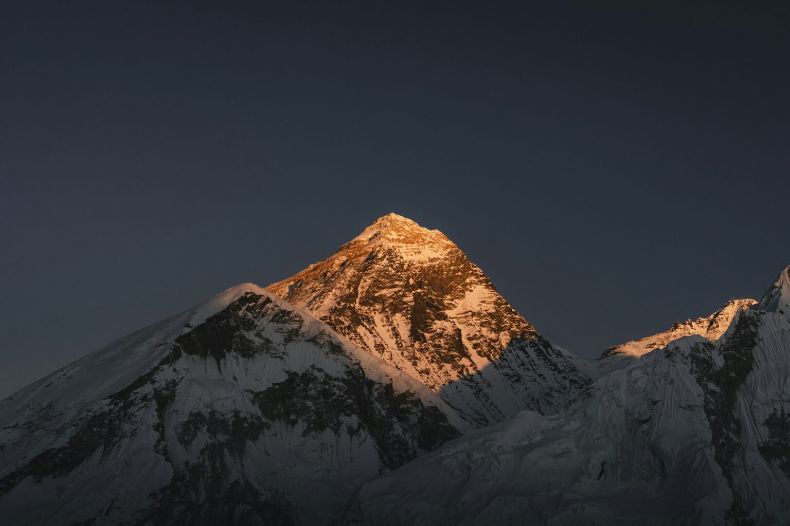
Some trips you only do once in your life, and Everest Base Camp is one of them. It’s two weeks walking up the Khumbu Valley, past monasteries, over suspension bridges strung across glacial rivers and through Sherpa villages of stone and wood, until you’re standing at the foot of the highest mountain on Earth. In Nepal they call it Sagarmatha, the forehead of the sky. To Sherpas and Tibetans it’s Chomolungma, usually translated as Mother Goddess of the World. See it once poking out above the clouds and you’ll understand why either name suits it better than Everest.
| Months | Everest Base Camp |
|---|---|
| March, April and May | Very good |
| October and November | Very good |
| First half of December | Good: cold and quiet |
| Mid-December to February | Very cold, many lodges close |
| June to September | Monsoon: we don’t run trips |
Spring and autumn are the two big seasons in the Khumbu. In spring the forests fill with rhododendrons in bloom, and in May base camp comes alive with the expeditions getting ready for the Everest summit. In autumn, just after the monsoon, the air is clean and the views are the clearest of the year, although October is the busiest month. The first half of December is a good option if you don’t mind the cold: clear skies and very few trekkers. From then until February the cold bites and many of the higher lodges close. From June to September the monsoon hides the mountains for weeks at a time and flights to Lukla are often cancelled.
Yes. Anyone healthy and fit can make it to Everest Base Camp. There’s no climbing and nothing technical. It’s a walking trek, many days in a row, and above all it asks for drive, determination and patience.
Patience is the key. You walk slowly because your body needs time to get used to the altitude, which is why the itinerary includes acclimatisation days in Namche and Dingboche. Up here the fastest walker doesn’t get there first. The one who climbs calmly and listens to their body does.
Long weekend hikes with some elevation gain, carrying the backpack you’ll take on the trip, plus a bit of weight training and some cardio during the week. And break in your boots before you go, never on the trek.
Going too fast in the first few days. At the start your body feels good and it’s easy to get carried away. The trouble comes higher up, when the altitude catches up with anyone who hasn’t respected the pace.
Not drinking enough. In the cold you barely feel thirsty, but at altitude your body loses a lot of water just by breathing. You need to drink even when you don’t feel like it, between three and four litres a day.
Keeping quiet when something feels off. A headache, nausea or unusual tiredness should go straight to your guide. The sooner an altitude problem is spotted, the easier it is to sort out.
Trying out new gear on the trip. New boots or an untested backpack can ruin the trek.
Carrying too much. The porter carries your duffel bag, up to 15 kg. In your daypack you only need the essentials: water, a warm layer, your rain jacket, sunscreen and something to eat.
Arrival in Kathmandu
The trip starts in Kathmandu. The moment you walk out of the airport the heat hits you and, almost always, someone puts a garland of orange marigolds around your neck to welcome you. Sometimes it’s a khata, a white silk scarf that Nepalis give to new arrivals to wish them good luck. It’s a small gesture, but it makes you feel welcome from the very first minute.
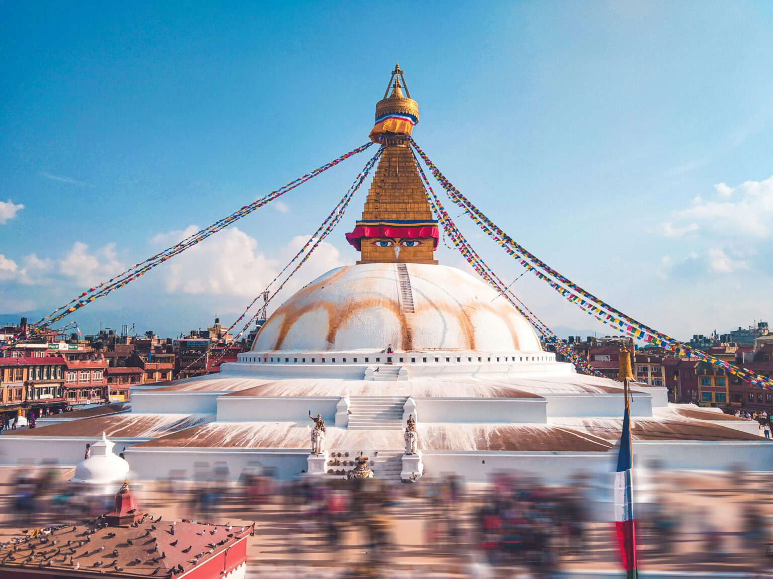
The drive to the hotel is an experience in itself. Kathmandu is a buzzing city, with chaotic traffic where motorbikes squeeze into every gap and horns never stop. Honking here isn’t rude. It’s simply how you let people know you’re there. Above the streets, power cables are tangled around the poles in a way that makes it hard to believe any of it works.
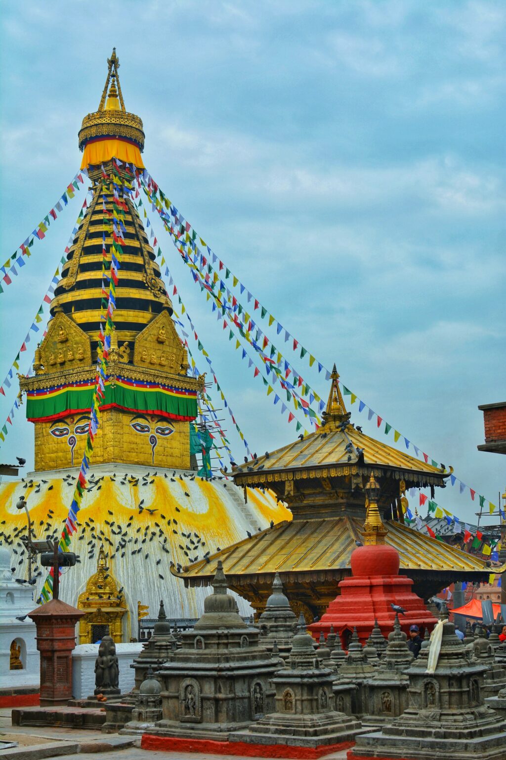
There’s something to look at on every corner: temples, little shrines with flowers and rice that locals leave every morning, women in colourful saris, monks, fruit sellers. The air smells of incense and spices. The first day can feel a bit overwhelming, but you get used to it fast, and honestly it has a lot of charm.
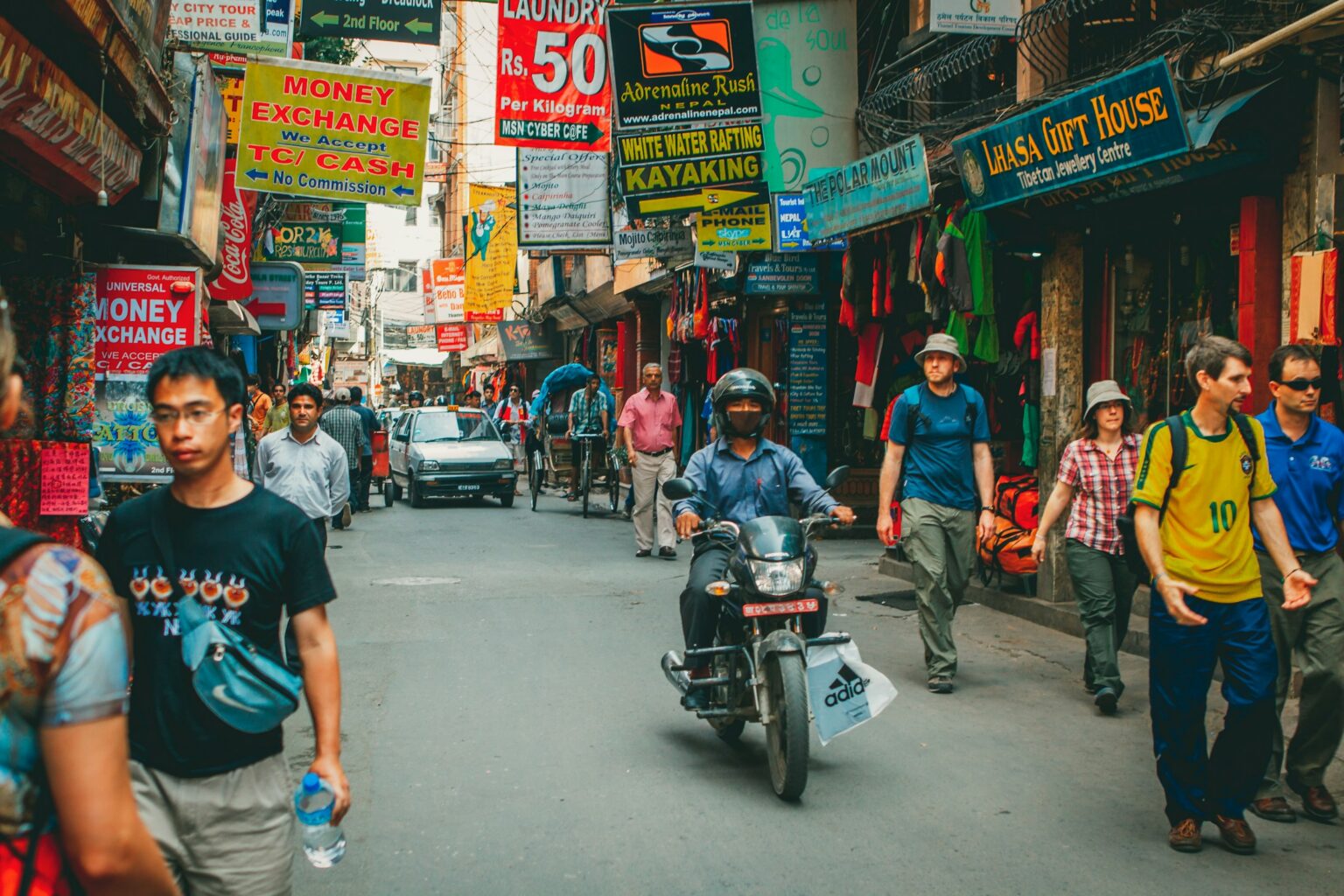
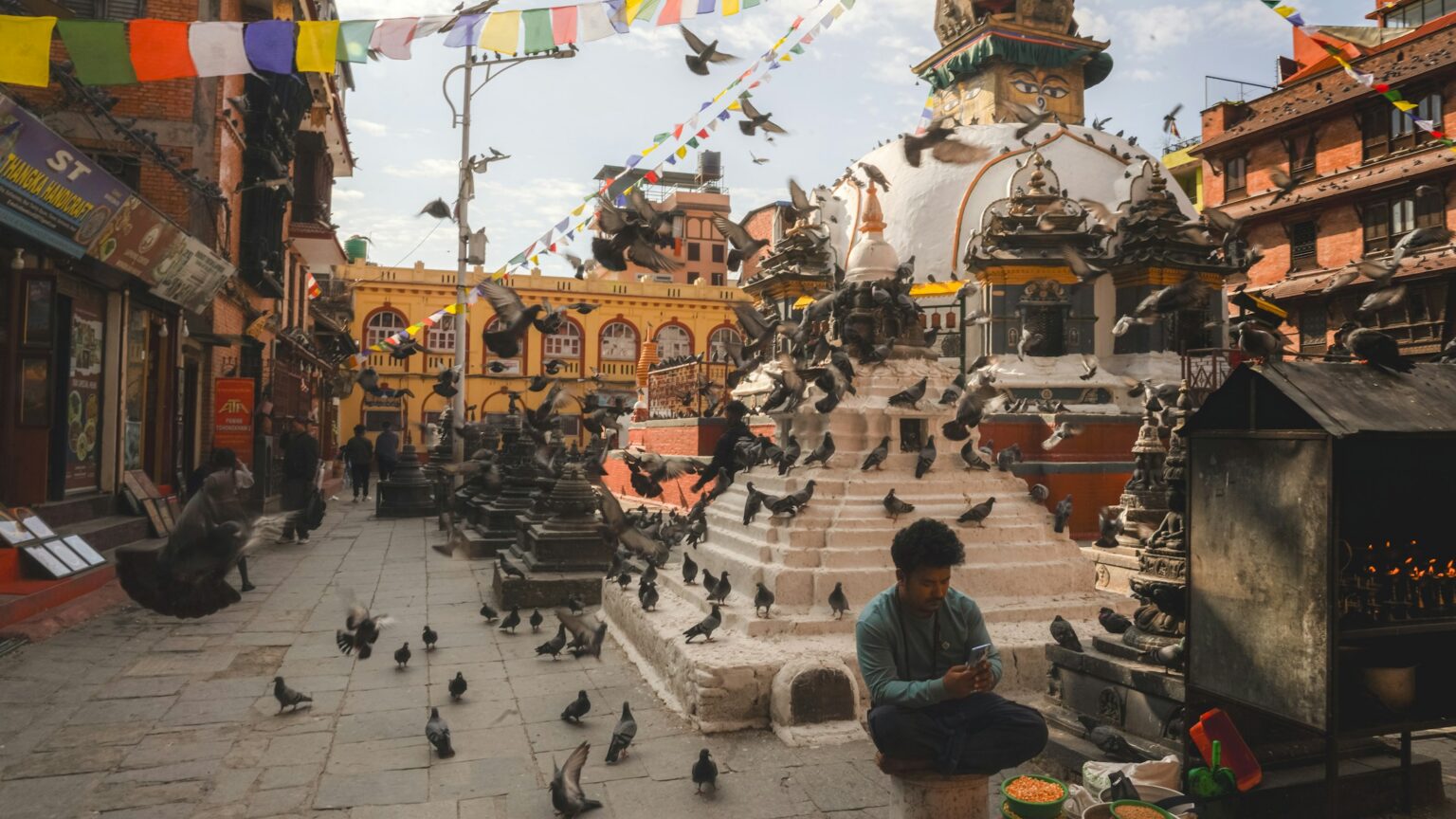
We stay in Thamel, the neighbourhood where nearly every traveller ends up. It’s the best place to pick up any gear you’re missing, because it’s packed with outdoor shops selling original brands as well as cheap knock-offs that hold up fine on a trek. That night the whole group has dinner together and we head to bed early, because the next morning is an early start for the flight to Lukla.
The flight to Lukla
The flight to Lukla is where the trek begins, and it’s one of the most exciting moments of the whole trip. Lukla airport is known as one of the most dangerous in the world: the runway is just over 500 m long, it slopes uphill and it ends at the mountain.
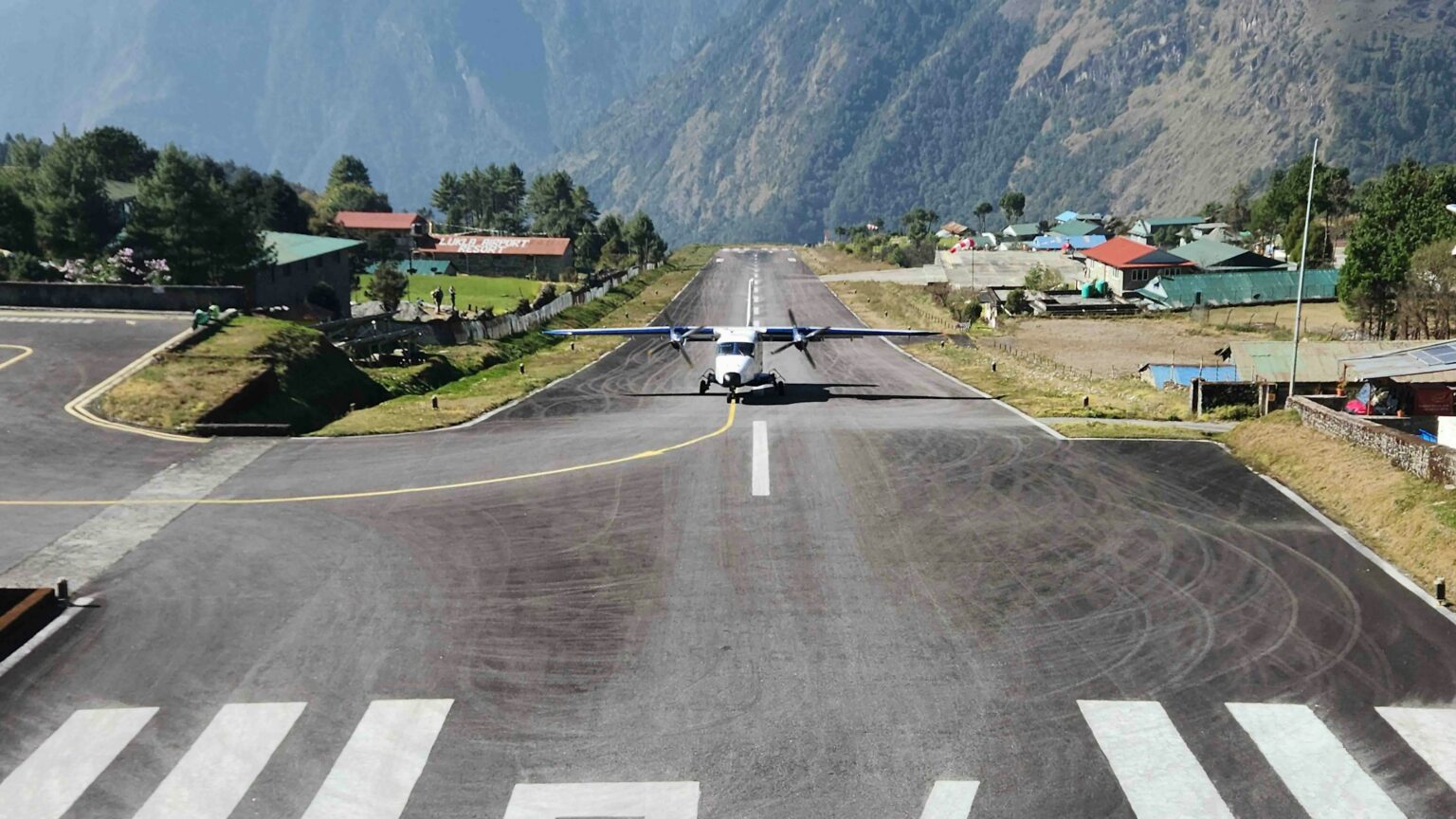
The small plane takes about 30 minutes from Kathmandu. Sometimes, in high season, the flight leaves from Ramechhap, about four or five hours away by road, and in that case we’d have to set off in the middle of the night. The flight itself is incredible. The plane threads its way between the valley walls, over terraced fields and tiny villages, until suddenly the runway appears, stuck to the side of the mountain. These flights only go when visibility is good, and if there’s cloud, you wait. Delays are normal, which is why the itinerary always leaves some spare time.
The other option is a helicopter. It’s more expensive and takes a little longer, between 50 minutes and an hour, but it can fly in weather that keeps the planes on the ground. It also flies higher, and the views are spectacular.
Lukla and the porters
Lukla sits at 2,860 m, and as soon as you step off the plane you notice the cooler air. This is where we meet the porters who’ll be with us the whole way. They tie the bags together in pairs, loop a strap over their forehead and swing them onto their backs like it’s nothing.
They’re a huge part of the trip and of life in the Khumbu. When they’re not working with tourists, they’re still carrying: they bring up from the valleys everything that’s sold and used in the villages, and some walk for a whole week to get goods to the market in Namche. They do it the way it’s always been done, with a wicker basket on their back, the doko, held by a strap across the forehead, the namlo, and a T-shaped stick to rest the load on when they stop.
On treks the rule is that they don’t carry more than 30 kg, but in their everyday work they sometimes carry 70 kg or more. On the trail you’ll see porters with gas bottles, timber, food and even fridges on their backs. Many come from very humble families, and what they earn in a season makes a big difference at home. While we’re kitted out head to toe, they walk up in simple clothes, move incredibly fast and almost always have a smile on their face.
Before setting off you walk along Lukla’s main street, lined with outdoor shops, cafés and bakeries. At the end is the permit checkpoint and, a little further on, the arch dedicated to Pasang Lhamu Sherpa. She was born in Lukla and in 1993 became the first Nepali woman to climb Everest. She died on the way down, and today the whole Khumbu municipality carries her name. Her story is told in the documentary Pasang: In the Shadow of Everest.
Day one: to Phakding
The first stage is short, three to four hours, and it’s a chance to find your rhythm. The trail drops down past small villages and fields, and soon you’ll see the first mani stones, rocks carved with the mantra Om mani padme hum, sometimes painted in bright colours and set into walls along the path. You always pass them on the left, keeping them on your right, so you go round clockwise, just like with stupas and prayer wheels.
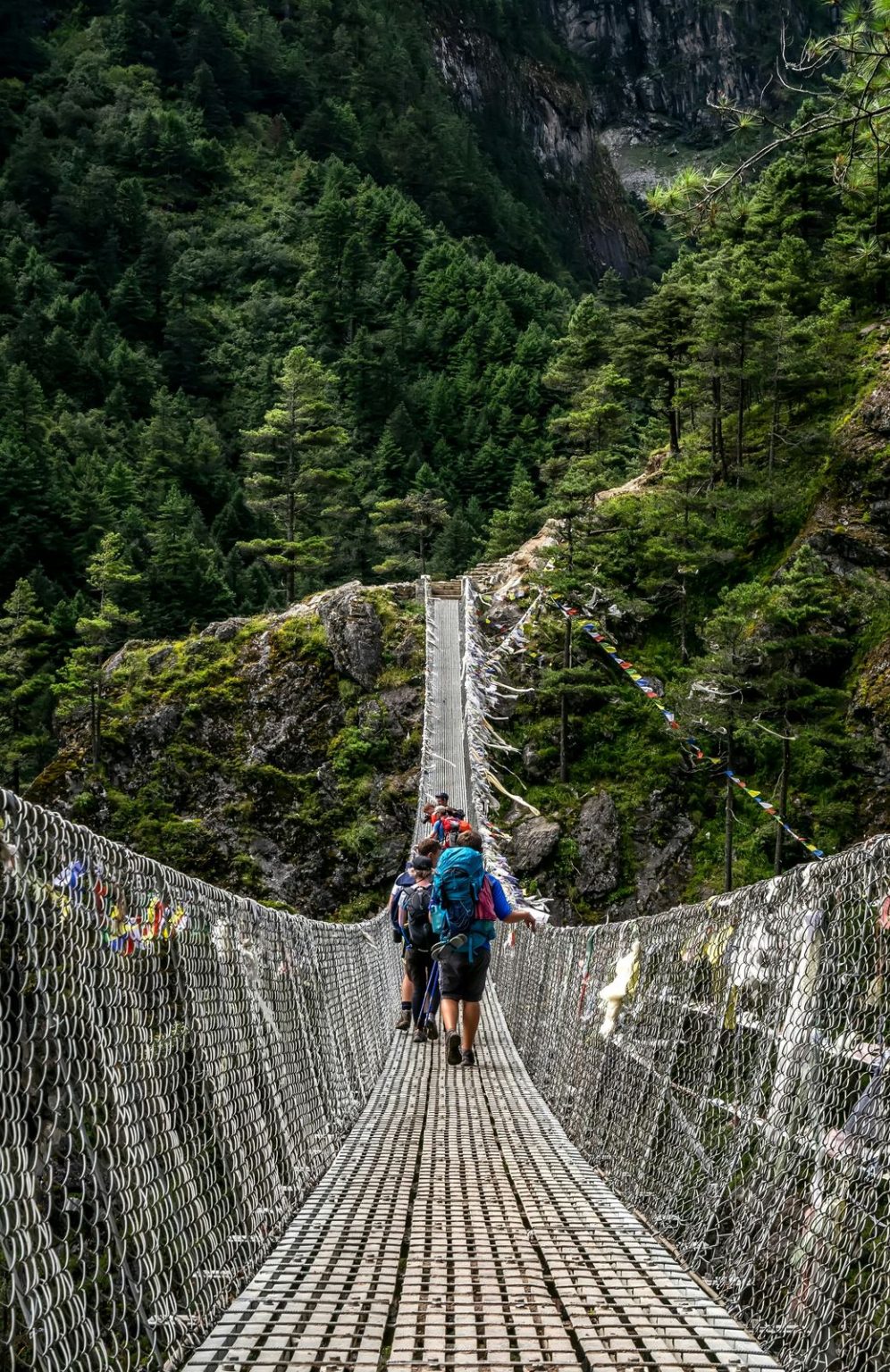
At one point the valley opens up and the Dudh Koshi appears, the “river of milk”, its white and turquoise water rushing down from the glaciers. From here on the trail never strays far from it. You cross the first suspension bridges and reach Phakding, right by the river, where we spend the first night.
This is where you get to know the teahouses, which will be home for the rest of the trip. Most are Sherpa family houses turned into small lodges, with simple twin rooms and no heating. These days there are also bigger lodges that feel more like a hotel, with private bathrooms, power sockets and even electric blankets, but the norm, and part of the experience, is the simple, family atmosphere that’s always been there.
The heart of every teahouse is the dining room. In the afternoon the stove gets lit and everyone gathers around it, trekkers, guides and porters, to eat, play cards, read or write. It gets cold early and there’s more walking the next day, so people turn in early. Just remember to order your breakfast before you go to bed.
Phakding to Namche
Day two starts beside the river, and before long you reach Monjo, the entrance to Sagarmatha National Park, where permits are checked. It’s been a World Heritage Site since 1979, and you can see why: pine and fir forests, waterfalls tumbling onto the trail and, in spring, rhododendrons in bloom, Nepal’s national flower, painting the hillsides red, pink and white. If you’re lucky you’ll spot a Himalayan tahr, a long-haired wild goat, or a musk deer among the trees.
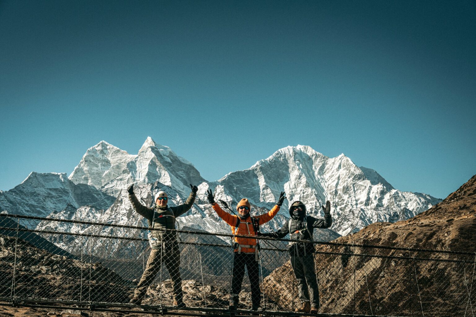
Through the morning you cross the river several times on suspension bridges, each one higher than the last, until you reach the most famous of them all, the Hillary Bridge. It hangs high above the point where the Dudh Koshi and Bhote Koshi rivers meet, and it’s covered in prayer flags. Each colour stands for an element: blue for sky, white for air, red for fire, green for water and yellow for earth. Tradition says the wind picks up the prayers written on them and carries them around the world.
Mule trains and loaded porters use these bridges too, so stay alert and wait your turn. If you meet animals, always step aside on the mountain side. The bridge sways quite a bit, so hold on tight.
Lunch is in the last village before the big climb, and straight after it the hill begins, about two hours zigzagging up through the pines. Halfway up, on a clear day, you get your first glimpse of the summit of Everest peeking out from behind other mountains. Then you pass the Namche permit checkpoint and, a few steps later, the village appears, tucked into the hillside like an amphitheatre.
Namche Bazaar
Namche sits at 3,440 m and is the Sherpa capital, the last big village before the high mountains. For generations it was the trading hub of the region, where people swapped salt, yak products and textiles, and there’s still a market every Saturday.
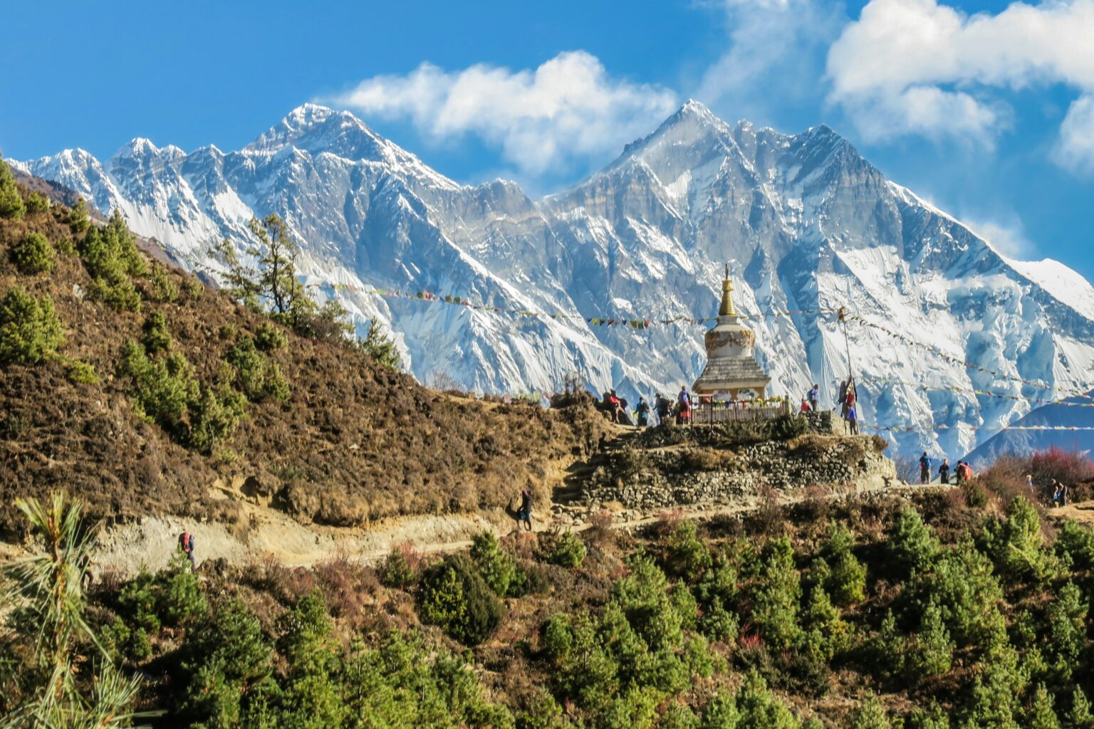
This is where one of the keys to the whole trip comes in: acclimatisation. You spend two nights in Namche so your body can adjust before going higher. From here on the rule is to walk slowly, even if you feel great. The higher you go, the less oxygen there is, and if you rush you’re asking your body for more than it can give. The Sherpas sum it up in two words: bistarai, bistarai, slowly, slowly.
The acclimatisation day isn’t a full rest day. You hike a bit higher and come back down to sleep. Close to the village there’s a square with a statue of Tenzing Norgay, the Sherpa who summited Everest with Edmund Hillary in 1953, and a small museum about the history of Everest and the Sherpas. You can already see the mountain from there, which makes it well worth the walk, because the Everest View Hotel sometimes wakes up wrapped in cloud. That hotel, at 3,880 m, opened in 1971 and holds the Guinness record as the highest luxury hotel in the world. On a clear day you can see Everest, Lhotse and Ama Dablam from its terrace.
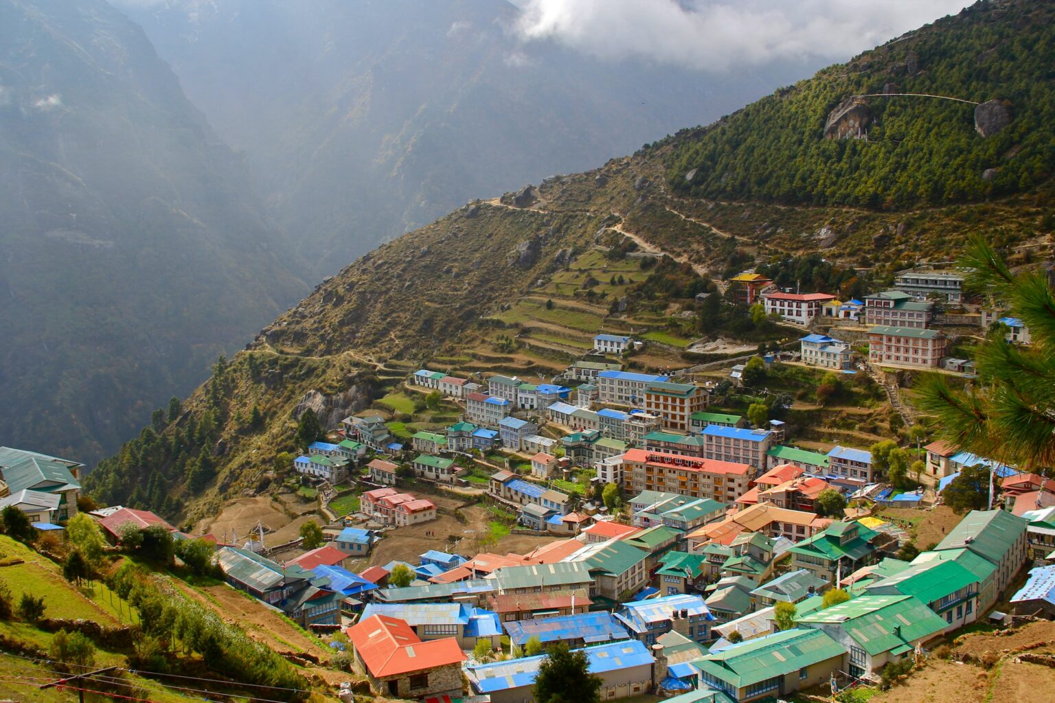
In Namche you have to stop by Sherpa Barista. As well as coffee, they make delicious pizzas, and the walls are covered in photos of people who’ve climbed Everest. The village has bakeries, cake shops, all kinds of restaurants and even an Irish pub that claims to be the highest in the world. It’s also the last place where eating meat is recommended, because higher up it arrives on the backs of porters or yaks, so it’s a good idea to ask your guide before you order. And it’s the last place on the trek where you can buy mountain gear.
Namche’s monastery is small, from the Nyingma school, with an interior painted in bright colours. It sits at one end of the village and plenty of people walk right past without noticing it.
Even when the weather’s good, always come prepared in Namche. More than once we’ve been caught here by heavy snow in the middle of the season. Every year is different.
Namche to Tengboche
You leave Namche on an almost flat trail cut into the hillside, passing Kyangjuma and Sanasa, two small clusters of houses with Tibetan handicraft stalls along the path. This stretch has some of the best views of the whole trek: on a clear day Everest, Lhotse and Ama Dablam appear straight ahead, and Ama Dablam stays on the horizon for the next few days.
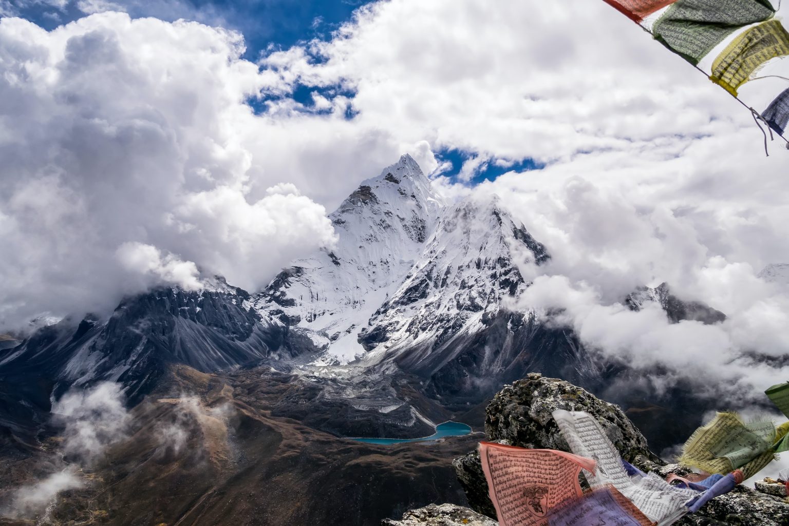
At Sanasa the trail splits. The left branch climbs into the Gokyo Valley and its turquoise lakes, a quieter variation we run on request. We cover it in Gokyo Lakes Trek and the Cho La Pass. We keep right, towards Tengboche.
From here the trail drops for a good while through pine and rhododendron forest to the valley floor at Phunki Tenga, at about 3,250 m, beside the Dudh Koshi. There are prayer wheels turned by the river, and it’s a good spot to stop for lunch before what’s left of the day. Then you cross the river and start the climb to Tengboche, about two hours through the forest, tough but beautiful. The whole day takes four or five hours, and although Tengboche is only about 400 m higher than Namche, with all the down and up you clock almost 900 m of elevation gain.
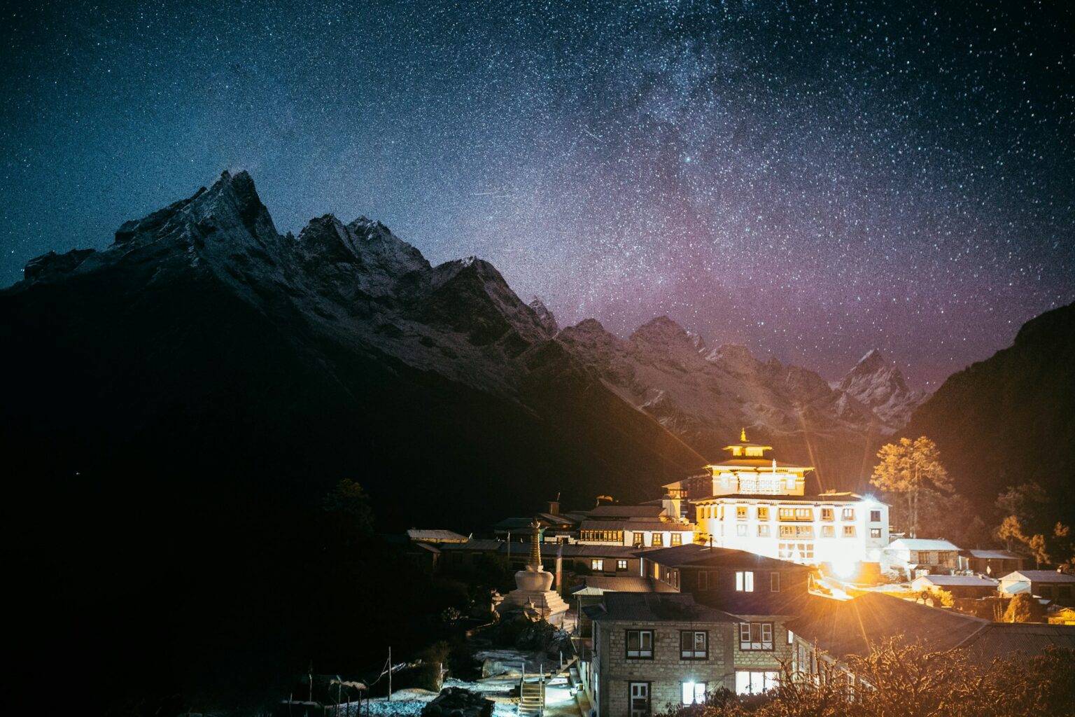
At the top, on a wide clearing facing Ama Dablam, stands the biggest monastery in the Khumbu. Lama Gulu founded it in 1916, linked to Rongbuk Monastery on the other side of Everest, in Tibet. The 1934 earthquake destroyed it and it was rebuilt, and in 1989 a fire wiped out many of its old scriptures and paintings. It was raised again thanks to donations from all over the world. Photos aren’t allowed inside, and that needs to be respected. If you arrive during afternoon prayers, you can slip in quietly, sit down and listen. The monks often give a blessing to those heading higher, and it’s a very special moment before the high mountains. In October or November it hosts Mani Rimdu, the most important Sherpa festival.
From Tengboche it’s about 20 minutes down through the forest to Deboche, where we sleep. It’s one of the best areas to see the danphe, a colourful pheasant that’s Nepal’s national bird.
Deboche to Dingboche
You leave Deboche through the last trees on the trail and cross the Imja River on a suspension bridge. Soon after you reach Pangboche, the last big village before the high mountains, with a monastery considered the oldest in the Khumbu. Lama Sangwa Dorje founded it in the 17th century, and for years it kept the so-called “yeti hand”, until it was stolen in 1991. People usually ask for a blessing here too, and it’s a good place to stop for tea with Ama Dablam right in front of you.
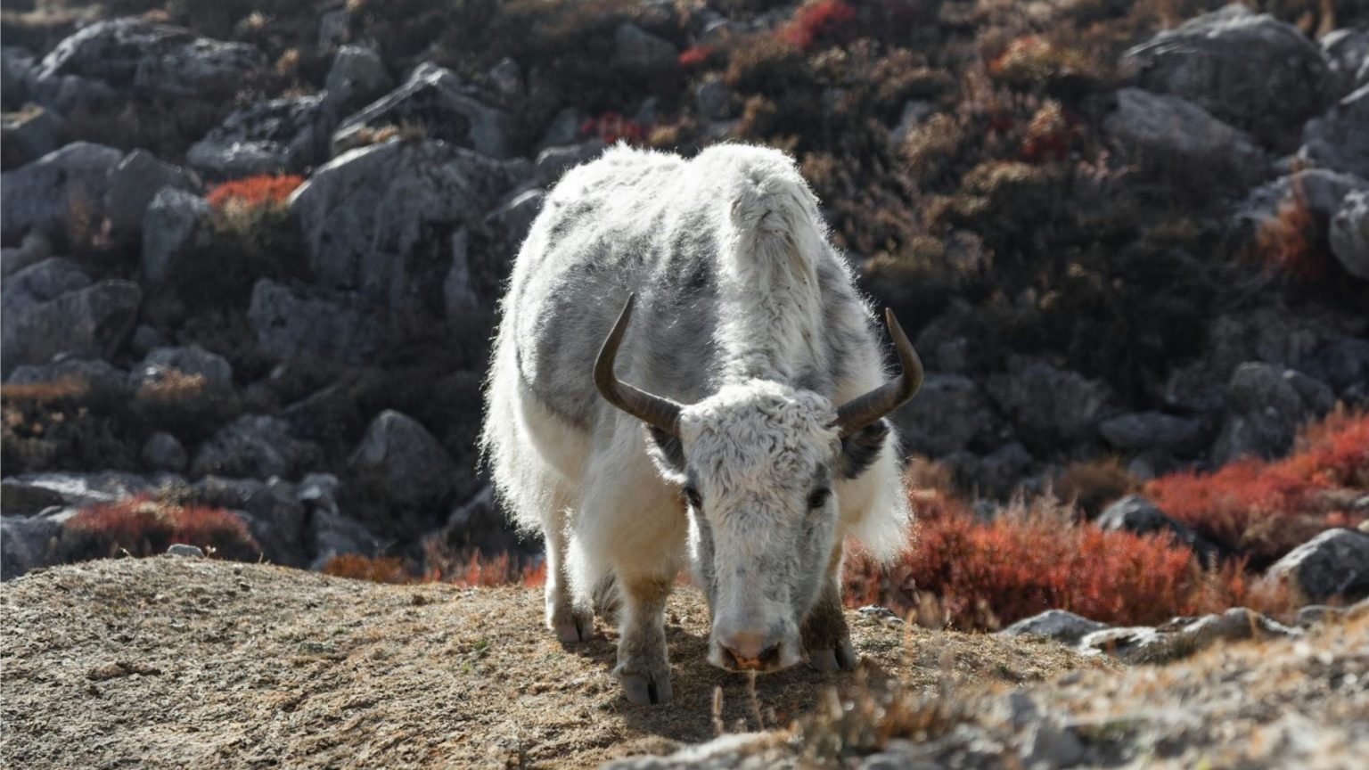
After Pangboche the landscape changes completely. The forests end, and in their place come low shrubs, stone walls and meadows where yaks graze. You hardly see any mules now. Up here loads are carried by yaks and dzopkyos, a cross between a yak and a cow, and the higher you go, the more yaks you’ll see, and the shaggier they get. When you meet a caravan, always step aside on the mountain side, never on the side of the drop.
The trail carries on above the river, through Somare and Orsho, to a junction where the paths to Pheriche and Dingboche split. We climb to Dingboche, at about 4,200 m, a village of stone houses surrounded by small walled fields of potatoes and barley. It’s normal to start feeling the altitude here: a bit of a headache, or not sleeping as well. Drink plenty of water and let your guide know.
Acclimatisation in Dingboche
You spend two nights in Dingboche, and on the day in between you hike high and come back down to sleep. The usual choice is Nangkartshang, a ridge above the village that tops out at 5,083 m. It’s about 700 m of climbing, roughly half a morning, and from the top you can see Ama Dablam, Lhotse, Makalu and Cho Oyu. You only take your daypack, and you don’t need to reach the very top. What matters is going up, staying there a while and coming back down.
Dingboche to Lobuche
You leave Dingboche climbing above the Pheriche Valley, an open, gentle stretch with Taboche and Cholatse on your left. After a couple of hours you reach Thukla, at about 4,620 m, a couple of teahouses by the river where nearly everyone stops for lunch.
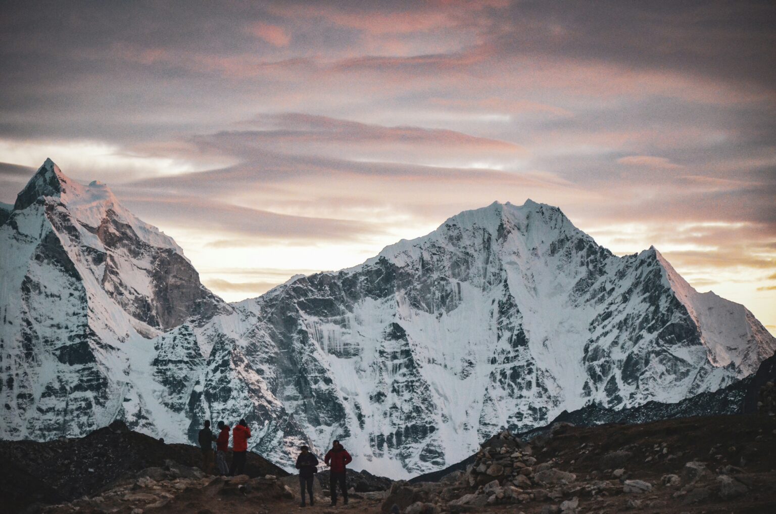
Right after that comes the Thukla climb, short but hard, almost an hour. At the top, on the pass, are the stone memorials to the climbers and Sherpas who died on Everest, surrounded by prayer flags. There are dozens of them, some with very well-known names, like Scott Fischer or Babu Chiri Sherpa. It’s a moving place that puts things in perspective, and most people stay a while in silence.
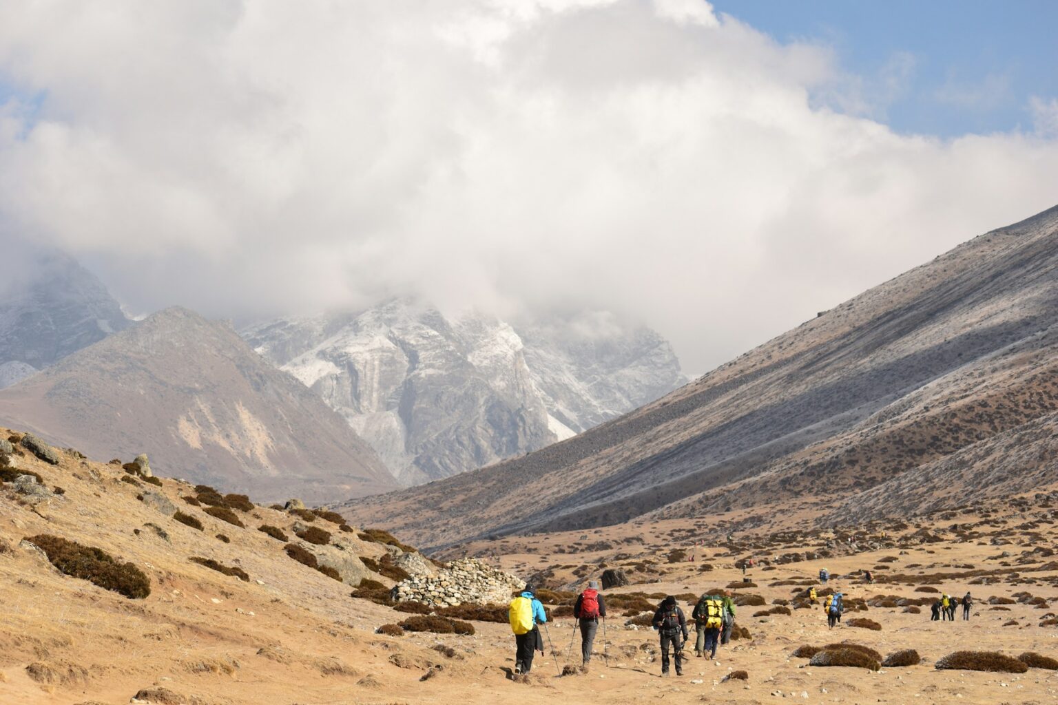
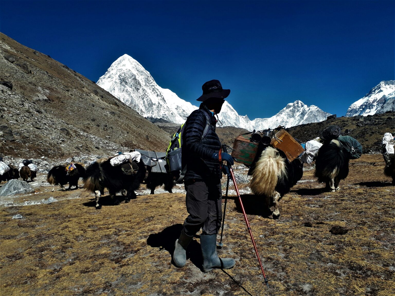
From the pass the trail eases off alongside the moraine of the Khumbu Glacier, with Pumori and Nuptse getting closer all the time. On your left rises Lobuche East, 6,119 m, one of the most beautiful peaks in the Khumbu and the one so many people stare at, already thinking about coming back. If that’s you, we climb it on our Lobuche East Expedition. And that’s how you reach the village of Lobuche, at 4,940 m. It’s the second-to-last village where you sleep, and you can feel it: it’s cold, there’s less oxygen and everything moves more slowly.
About 20 minutes from Lobuche is the Pyramid, an Italian research lab built in 1990 at 5,050 m. It’s been used to study glaciers, the climate and even the exact height of Everest. It’s a glass pyramid sitting in the middle of all the rocks, and it’s worth walking over to see it if you’ve got the energy.
The big day: Gorak Shep and Base Camp
You leave Lobuche early, because it’s a long day. For the first few hours the trail follows the Khumbu Glacier, and it soon heads onto the moraine, an awkward up and down over loose stones and rock where, at this altitude, every little rise takes it out of you. In about two or three hours you reach Gorak Shep, at 5,164 m.
Gorak Shep is little more than a handful of teahouses next to an old lake bed covered in grey sand. It was the first Everest base camp, used by the 1952 Swiss expedition, before it moved closer to the Icefall. Here you have lunch, drop your bags and carry on to Base Camp.
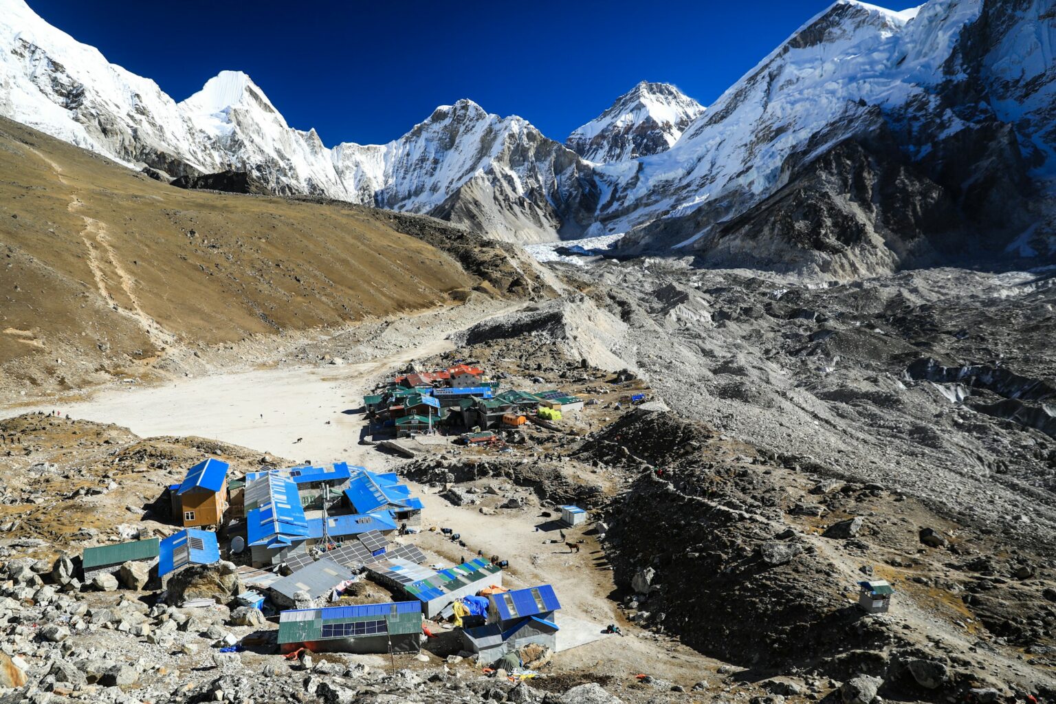
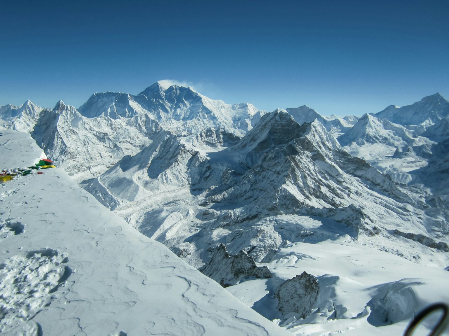
From here the landscape changes completely and you can feel you’re in the high mountains. The trail runs along the edge of the glacier, with huge walls on either side: Pumori, Lingtren, Khumbutse and Nuptse, enormous and closer with every step. Below you lies the Khumbu Glacier, a river of ice and rock with towers of bluish ice poking out of the rubble. This stretch takes about two hours, over ground that changes every year, so take it slowly and follow the little stone cairns that mark the way. Then all of a sudden the valley opens up and there’s Base Camp at the far end, with the Icefall behind it. It’s one of those moments you never forget.
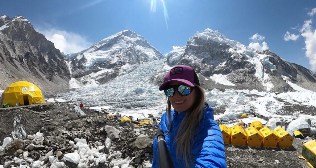
Base Camp sits at 5,364 m, at the foot of the Khumbu Icefall, the first big obstacle for anyone climbing Everest. The rock that marks it is covered in prayer flags, and it’s the photo everyone wants. Funnily enough, you can’t see the summit of Everest from here, because its own neighbouring peaks hide it. But that doesn’t matter. We’ve spent days watching it appear and disappear, and being there is what counts.
In spring, Base Camp turns into a village of colourful tents, full of expeditions preparing for the summit. At that time of year we spend a night at Base Camp itself, in a tent, right in the middle of it all. It’s an experience almost nobody gets to have, and one of the things that makes our spring trip special. In autumn there are no expeditions, so we head back to Gorak Shep to sleep.
The descent
The descent takes three days, via Pheriche and Namche, down to Lukla. You go down much faster than you came up: your body gets oxygen back with every metre, your legs are tired and the feeling of having made it takes over everything. In Namche you’ll be craving another pizza at Sherpa Barista, and in Lukla we celebrate our last night in the mountains with the team.
If you’re short on time, there’s a way around it: you can fly back by helicopter from several points along the trail. You save days of walking down, and you get to see the Khumbu from the air, which is quite a sight. Ask us about the options.
From Lukla you fly back to Kathmandu. The itinerary leaves a spare day in case the flight is delayed by weather, and if you don’t need it, it’s the perfect chance to wander the city with fresh eyes.
There’s much more to the Khumbu than mountains. Along the way, the daily life of the Sherpas finds its way into your trip, and it’s one of the things people remember most once they’re home.
Teahouses are family businesses. Often several generations work there at once: mum in the kitchen, the kids serving tables and the grandparents by the stove. They open for the season, and in winter many of the higher ones close while the families move down to Kathmandu or to lower villages.
The stove runs on yak dung. Above the forests there’s no firewood, so the fuel has always been dried yak dung. On the trail you’ll see the patties stuck to the walls of houses, drying in the sun. It might sound strange, but they give off plenty of heat and barely smell.
Yaks are the trucks of the Khumbu. Above a certain altitude there’s no other way to move things: food, gas, expedition gear… it all goes up on the backs of yaks or porters. That’s why everything gets pricier the higher you go, from a bottle of water to charging your phone.
The schools owe a lot to Edmund Hillary. After climbing Everest, Hillary set up the Himalayan Trust and, together with the Sherpas, built schools and hospitals all over the valley, starting with the school in Khumjung in 1961. It’s one of the ways Everest gave something back to the people who live at its feet.
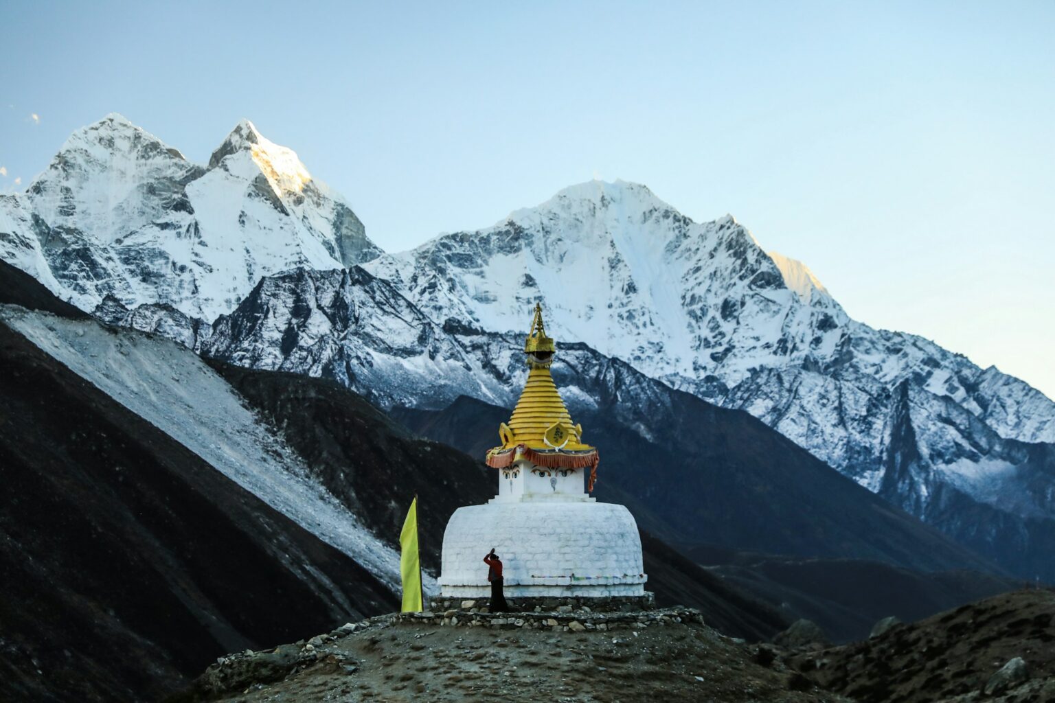
Buddhism is everywhere. Mani stones, prayer flags, stupas, prayer wheels and monasteries line the whole trail. Remember to always pass them on the left, keeping them on your right, clockwise.
Gokyo and the Cho La. From Sanasa, just past Namche, you can head up the much quieter Gokyo Valley to its turquoise lakes and Gokyo Ri, where you can see four 8,000 m peaks at once. Then you cross the Cho La pass and link up with the Base Camp route. We run it on request, and we tell you everything in Gokyo Lakes Trek and the Cho La Pass.
Lobuche East. If you want a summit, from Lobuche you can climb Lobuche East, 6,119 m, with fixed ropes on the final section and views of Everest, Lhotse and Nuptse you won’t forget. All the details are on our Lobuche East Expedition page.