
At the southern tip of Chile, where the Patagonian steppe runs into the Andes, a block of granite rises abruptly more than two thousand metres above lakes of an almost unreal turquoise. This is the Paine massif, and the W is the classic way to explore it on foot. The trek takes its name from the letter it traces on the map: three climbs that cut into the massif — to the base of the Towers, up the French Valley and towards Grey Glacier — linked by a trail that runs along the shores of Lake Nordenskjöld and Lake Pehoé.
It covers about 76 kilometres over four or five days, sleeping in mountain refuges or campsites, and it packs in the very best of Torres del Paine: the three granite towers that give the park its name, the two-toned silhouette of the Cuernos, the hanging glaciers of Paine Grande and the blue ice of Grey Glacier, flowing down from the Southern Patagonian Ice Field. Along the way you are likely to pass herds of guanacos, watch condors circling the ridges and, with a little luck, spot the tracks of a puma.
The park lies in Chile’s Magallanes region, about 112 kilometres north of Puerto Natales. It became a national park in 1959 and a UNESCO Biosphere Reserve in 1978. The W follows its southern side, the best-known part of the park; if you want to walk all the way around the massif, the O Circuit adds the northern side and the John Gardner Pass.
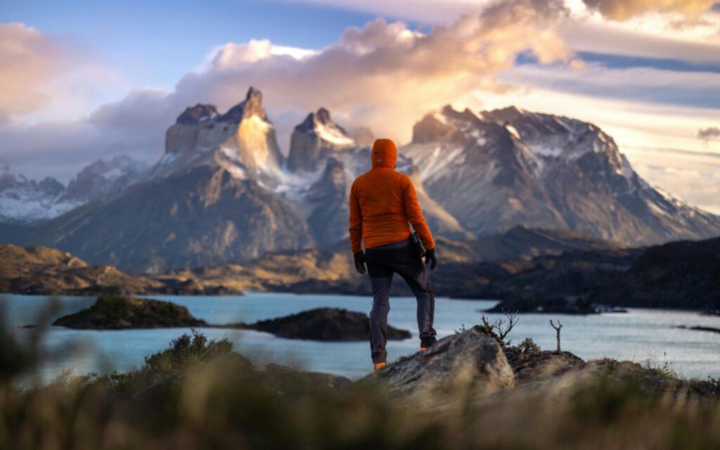
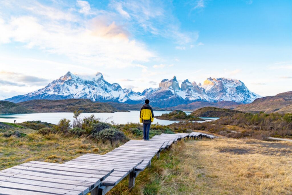
Base Torres. The hardest climb and the most famous. From the Central sector the trail heads up the Ascencio Valley, crosses the Paso de los Vientos, passes the Chileno sector and climbs through lenga forest to the final stretch: about an hour over a moraine of loose rock that ends at the lake at the foot of the three granite towers. The round trip is about 20 kilometres and takes 8 to 10 hours.
Along Lake Nordenskjöld to the Cuernos. A gentler day along the shore of a lake named after the Swedish explorer Otto Nordenskjöld, who travelled through Patagonia in the 1890s. On one side rise Mount Almirante Nieto and its hanging glaciers; ahead, getting closer with every step, the Cuernos, with pale granite at the base and dark rock on top. About 16 kilometres and roughly 6 hours to the Francés sector.
The French Valley. For many, the best day on the W. The trail climbs between the hanging glacier of Paine Grande, which sheds blocks of ice with a roar that echoes around the valley, and the walls of the Cuernos: first to the Francés viewpoint and then on to the Británico viewpoint, in an amphitheatre of granite. About 15 kilometres and 8 to 12 hours, there and back.
Paine Grande and Grey Glacier. The final stretch leads to Paine Grande, beside Lake Pehoé, and on to Lake Grey, with its blue icebergs, and the glacier viewpoint. Grey Glacier is a tongue of the Southern Patagonian Ice Field, the largest body of ice in the southern hemisphere outside Antarctica. To leave the park you cross Lake Pehoé by catamaran.
You can walk the W in either direction. Going east to west, you start with the climb to Base Torres while your legs are fresh and finish with the Lake Pehoé catamaran. Going west to east, you save the Towers for the last day, as a grand finale.
On our W Trek we walk east to west: the hardest stage comes on day two, while you are still fresh, and from there each day gets a little easier. Whichever way you go, your itinerary has to match the nights you have booked.
On the W you sleep either in refuges, in shared rooms with meals if you book them, or at campsites, with your own tent or one already pitched. All the accommodation on the route is run by two companies, Las Torres Patagonia and Vertice Patagonia, and each one is booked separately.
Bookings are compulsory. Every night inside the park has to be booked before you enter, and the rangers check. You cannot just turn up and camp.
Park entry is bought online, at pasesparques.cl, before your trip. There is almost no signal inside the park, so keep the ticket downloaded on your phone.
It sells out early. From December to February the refuges fill up months in advance. Fitting together nights from two different companies so that the itinerary works is what makes organising the W on your own complicated.
The season for hiking without a guide runs from October to April. December, January and February are the southern summer: very long days, with light until after ten at night, and also the busiest refuges. October, November, March and April are quieter and a little colder; by late March the lenga forests begin to turn red. Outside the season, roughly from late April to mid-September, the park requires an accredited guide.
The weather rules at any time of year. In Torres del Paine it is normal to get sunshine, rain and very strong wind on the same day, and gusts can force you to stop on the most exposed sections. Layers and a good waterproof jacket, always.
Our guided departure is 11–15 March 2027, staying in refuges, from $2,990.
See the Torres del Paine W Trek
The gateway is Puerto Natales. The usual route is to fly to Santiago de Chile, take a domestic flight to Punta Arenas, about three and a half hours, and then a bus to Puerto Natales, about three hours more. In season there are also direct flights from Santiago to Puerto Natales. From the town to the park it is about two hours by road.
With the connections and the time difference, the sensible thing is to arrive in Puerto Natales at least the day before you start walking.
In season a guide is not compulsory, and many people walk the W on their own. What you cannot skip is having everything booked and lined up: accommodation, park entry, transfers and the catamaran.
A guide makes sense if you want to forget about all that logistics, if you are travelling alone, or if you would rather have someone who knows the terrain when the weather turns: what time to set off for Base Torres, how far to go up the French Valley, or when to turn back. You also learn far more about the park, its wildlife, its glaciers and its history.
We organise both options: the guided W Trek, staying in refuges, with a departure in March, and the self-guided O Circuit, on request, for those who want the full loop.
How many days do you need for the W Trek?
Four or five days on foot. Our programme is 5 days from Puerto Natales, with 4 nights in refuges.
How long is the W Trek?
About 76 kilometres, including the three climbs: Base Torres, the French Valley and Grey Glacier.
How hard is the W Trek?
It is challenging but not technical: days of 6 to 10 hours, with the final climb to Base Torres over loose rock as the toughest section. You need good fitness and to be used to walking several days in a row.
Do you need a guide for the W Trek?
From October to April a guide is not compulsory. Outside the season the park requires an accredited guide. What you always need is every night booked and your park entry bought.
Which is better, the W or the O?
The W is shorter and takes in the park’s great icons. The O adds the northern side, wilder and quieter, and the John Gardner Pass: it takes about eight days and is more demanding.